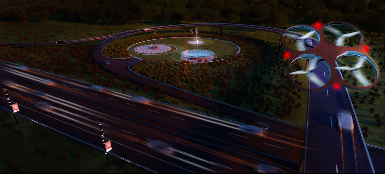
International design and innovation office CRA-Carlo Ratti Associati has been working with Italy’s leading road agency ANAS to design a Smart Highway program that will be implemented on more than 2,500 kilometers of roads and highways. The project involves a pioneering infrastructure system featuring drones that are able to deliver first-aid support, as well as sensing poles that can send useful information to both today’s drivers and tomorrow’s self-driving vehicles. The program experiments with new ways of gathering and sharing data about mobility, with the objective of improving safety conditions and traffic management.
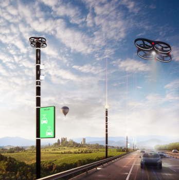
The new infrastructure revolves around a series of “flying poles,” which incorporate multiple sensors and in-motion Wi-Fi connection services. On top of each pole is a recharging station from which drones can take off and start monitoring the road. Thanks to the data collected by the poles, the system can inform drivers, in real time, of the conditions of the road ahead. Direct, customized messages can be sent to each driver’s mobile phone or to each vehicle’s on-board navigation system, which in turn can give their own feedback back to the system.
“We are living in a time of momentous changes in the field of mobility. The Internet has radically transformed the way we get around, and how we design our roads,” says Carlo Ratti, founding partner at CRA and professor of the practice of urban technologies at the Massachusetts Institute of Technology (MIT): “With this project, we aim to superimpose a digital layer over the existing physical infrastructure of our road network, to gather better data about our highways. The next step will be to pool this data with information already collected by individual cars, in an ‘Internet-of- Roads’ scenario that will make us ready for the other revolutionary breakthrough that is likely to happen in the next decade: the arrival of self-driving vehicles.”
The “flying poles,” located at regular intervals, feature an array of sensors detecting all major environmental variables, from air pollution to wind speed, humidity, and weather changes. Furthermore, the poles power a Wi-Fi system that allows people to stay connected to the Internet while on the run, while a low-energy information panel displays useful information to the driver.
Taking off from the recharging stations located on the tops of the poles, the drones represent a dynamic integration into the new infrastructure. They can serve different purposes primarily related to safety and maintenance – from monitoring tunnels, viaducts or other remote pieces of infrastructure, to bringing medicine or other first-aid equipment to drivers, to detecting accidents, fires or floods happening close to a highway.
“For future developments in mobility, we do not necessarily need more infrastructure, but better infrastructure. Gathering data is crucial to achieving the objective of increased road efficiency,” says Saverio Panata, project leader at CRA: “In this new project we are developing with Anas, information feedback loops are built into the system, so that all participants can contribute to a smoother and safer journey.”
In late December 2017, ANAS launched a 30-million-euro call for proposals, aimed at contractors, to build the new Smart Road infrastructure according to CRA’s design specifications, including the development of new data centers (https://acquisti.stradeanas.it). CRA’s collaboration stands out as part of a larger digital transformation initiative put forward by Italy’s road agency over the last few years, covering about 10% of the 26 thousand kilometers of roads and highways that ANAS oversees.


